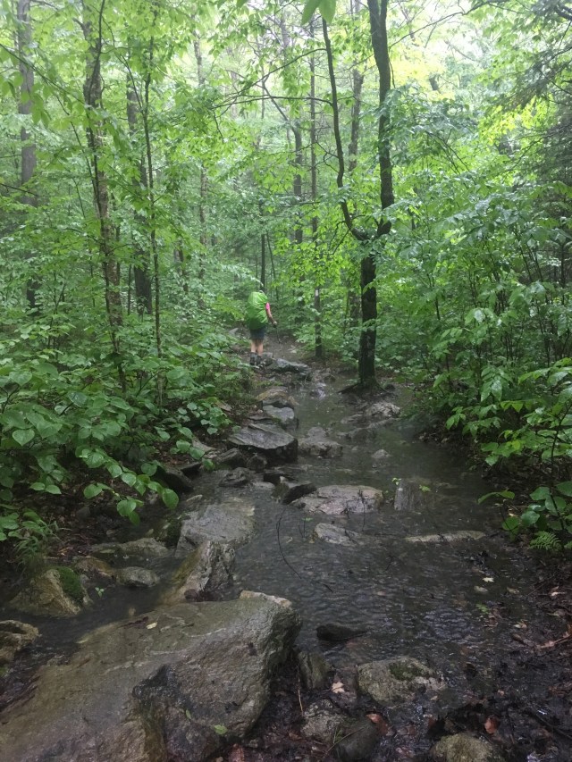
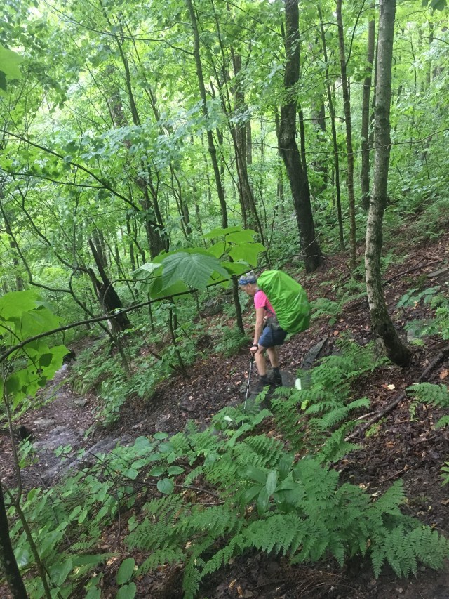
This trail is an ass kicker. I loved it but I would not recommend it to everyone by a long shot. If you are used to hiking out west on beautiful clear trails with a maximum 10% grade, switchbacks and constant views and that’s what you love, this is not the trail for you. If you love hiking in the Adirondacks and in Vermont where you just walk straight up a mountain, through fallen trees and shrubbery, walking up streams, enjoying thick forest and foggy days, this is the trail for you. By the end of section 1 my mom was taking all of the pills in our first aid kit. When we started the trail I had no knee braces. When finished the trail I was wearing one on each knee and switching them back and forth to maximize support. The Vermont Long Trail is also called the Mud Trail. When you get to a “stream crossing” and you don’t see the trail on the other side, it’s because the stream is the trail. There are entire sections of the trail that are slick rock and ladders, and there are moments where you are having to do actual rock climbing with a pack on. If you love Vermont, love a challenge, and want to work hard for your views this is the trail for you. If you want to enjoy every minute of your hike and be basked in the breathtaking grandeur of nature’s scenery as you stroll casually through the mountains, this is not the trail for you. I won’t even mention the bugs. This is not John Muir and Ed Abbey, this is the OG Badasses: Thoreau, Emerson and Frost. Especially Frost. This is the oldest long trail in the country: A Footpath Through the Wilderness.
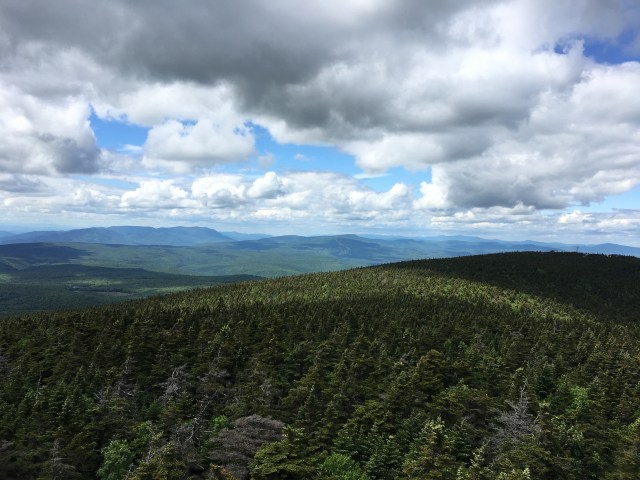
Section 1: 0- Southern Terminus to 86.5-Clarendon Gorge: The entire first section overlaps with the Appalachian Trail. We were fortunate to be on the trail early enough that the main bubble of AT hikers had not arrived, but there were still more people than we were used to on long trails. This is also the lowest elevation section, even on ski mountains the trail doesn’t always summit.
Trail Day 1 (June 18) : Pine Cobble Approach Trail to Seth Warner Shelter (~2 miles on Long Trail)


Trail Day 2 (June 19): Seth Warner Shelter to Melville Neuheim Shelter (13.1 m)


Trail Day 3 (June 20): M.N. Shelter to Kid Gore Shelter (12 m)


Trail Day 4 (June 21): Kid Gore Shelter to Stratton Pond (14.6 m)


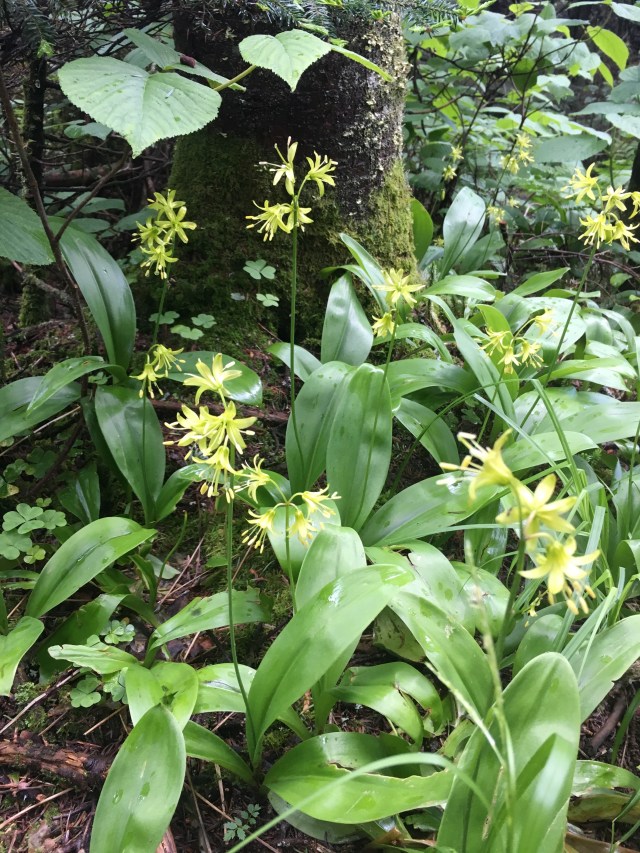
Lady slippers may be the ugliest orchid in the world.

Trail Day 5 (June 22): Stratton Pond to Bromley Shelter (12.1 m)


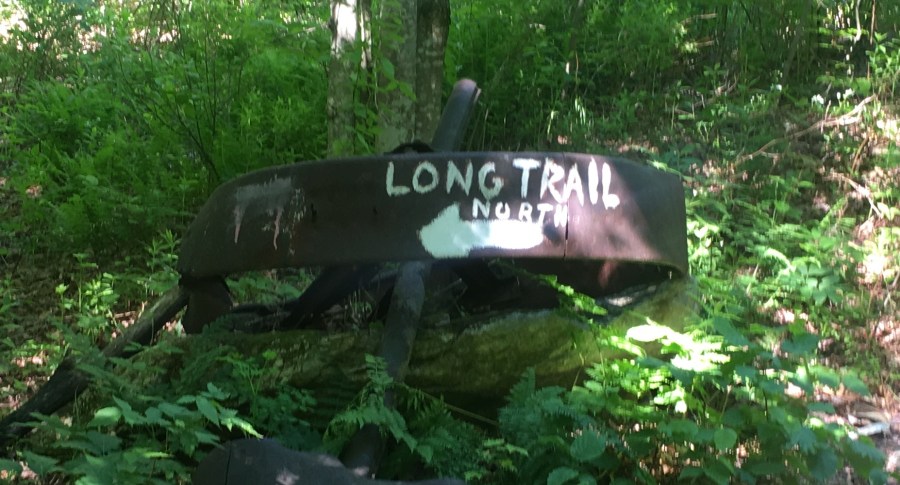
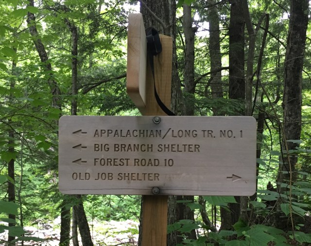
The day of sassy signs near Prospect Rock

Trail Day 6 (June 23): Bromley Shelter to Big Branch Shelter (15.1 m)


Trail Day 7 (June 24): Big Branch Shelter to Clarendon Gorge (15.1 m)


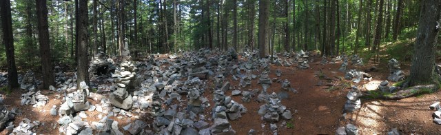
This was the White Rocks area, approaching it I couldn’t figure out why “cairns” was marked on the map….until we got there. We did our part and contributed to the crazy cairns. Up to this point this was my favorite day on the trail in terms of the trail itself. It was so different and the trail was covered with springy pine needles. But my knee was becoming a problem. I’ve always had problems with my right knee (I mentioned I grew up in the Adirondacks and Vermont, Lyme Disease is part of the package) but I could barely walk on my left leg. I realized later that a piece of the heel of my left sneaker had come off and it was changing my stride. It’s the only thing I can think of that made my left knee go first.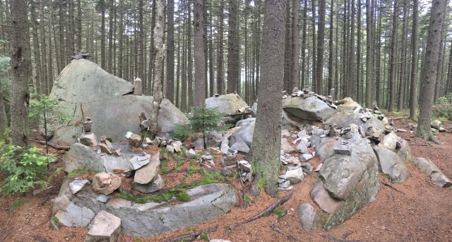


The plan was that when we got to Clarendon Gorge my aunt would meet us there and resupply. My mom had been having issues with both knees all week (likely caused by her hiking boots, more on that later), and by the time we got to the parking lot I literally couldn’t walk. The entire way down the trail to the gorge I was using my poles as crutches and not bending my left knee at all. My aunt didn’t hesitate, after handing us each a beer (which went great with the ibuprofen I had just popped) and giving our hiking buddy Half Blind a seltzer she took us to her house for some R&R and much needed new shoes for both of us.

That looks amazing! I started out with knee problems and have been through a few pairs of shoes in order to solve it.
LikeLike
Great information! Thanks! I was wondering when you started your Long Trail hike. I am guessing late August?
LikeLike
I actually started mid June (the 18th). Definitely on the early end which was nice in terms of less traffic on the AT, cooler weather and fewer bugs (which is why we picked that start date) but it was definitely the height of rainy weather.
LikeLike